Many factors contribute to producing the perfect aerial photograph. When shooting outdoors weather conditions such as the amount of sunlight, cloud coverage, length of day (depending on time of year) and wind speed can make or break a day of aerial photography and is the one thing we have no control over. The scale of the aerial photo can also cause challenges, for photographing buildings (ex. corporate headquarters or apartment complex) and houses the photographer will have a smaller focal point and intermittent cloud coverage becomes less of a factor. When BP imaging’s aerial photographers shoot larger scale areas, the weather has to be near perfect with minimal to no clouds to avoid intruding cloud spots in the photograph.
Mapping The Flight
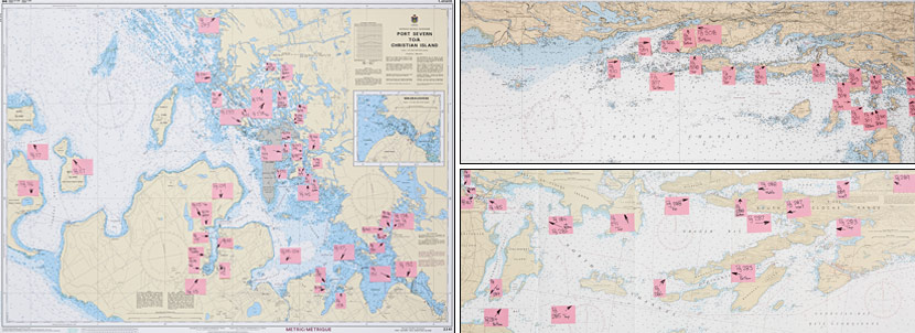
A challenge that was evident in photographing aerials for the Trent-Severn Waterway & Lake Simcoe Cruising Guide, was the ability to locate the proper areas that required photography, especially when there are no pertinent land marks to assist you. The photos below gives you an idea of the hours of planning and organizing that is essential to complete before taking off to shoot the aerial photographs. All of the pink sticky notes on the maps are a specific page number the photograph appeared on in the previous Cruising Guide for guidance in setting up the proper angle for the new picture. As you can imagine the task is quite tedious and although the Cessna 172 (aircraft) was equipped with a GPS system there were no labels on the islands or surrounding land, only outlines.

Trent-Severn Waterway and Lake Simcoe
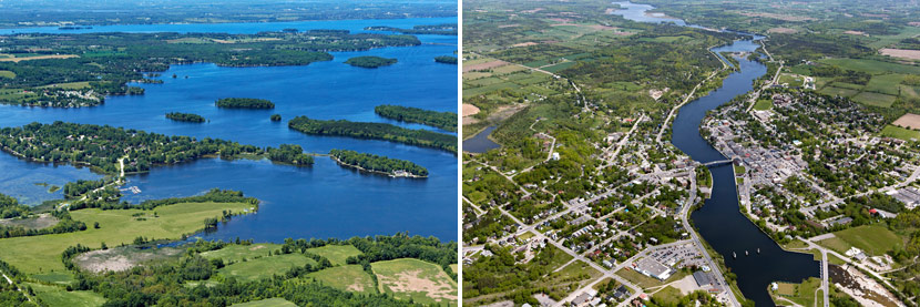
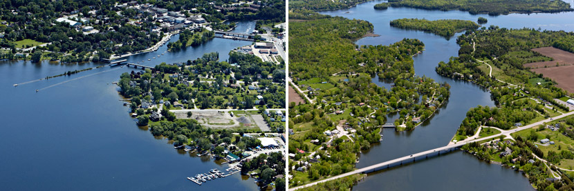
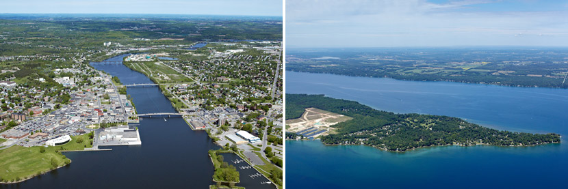
BP imaging has shot aerial photographs for the PORTS Cruising Guide for the past 2 years. Our aerial photographers, in 2012, photographed for the Trent-Severn Waterway and Lake Simcoe Cruising Guide. The Trent-Severn Waterway is one of the top locations in Canada for boating, stretching approximately 385 kilometers from Trenton to Port Severn. In 2013, BP imaging shot aerials for the Georgian Bay, The North Channel & Lake Huron Cruising Guide. The information guide documents the traveling route along the waterway from Sarnia to Sault Ste. Marie and The Thirty Thousand Islands. Next Spring/Summer BP imaging will be shooting for the Lake Ontario Cruising Guide. The photography that is labelled and made into a “satellite” like map along the waterway with graphic maps also used in the guide.

The Cruising Guide is a perfect tool for traveling boaters that displays the birds eye view of routes, and lock systems along connecting waterways with GPS coordinates to make the best of your adventure. The aerial images included in the book are provided with detailed traveling information such as nearby marines, fuel stations, restaurants, cities/towns, local attractions, areas for anchoring and overnight stay/docking. The birds eye photographs provide changes in all aspects of the environment along the waterway such as water levels, infrastructure, areas of caution and architecture of cities/towns.

Be sure to view BP imaging’s Aerial Photography Portfolio and microsite focused solely on aerial photographs of the Southern Ontario region. Locations include Toronto, Hamilton, Niagara, Windsor and Kitchener/Waterloo to as far as Ottawa and Sudbury! For more aerial images of the Trent-Severn Waterway see our past blog “A trip over the Trent-Severn Waterway.”


